
Song of the Day: Humbug Mountain Song — Fruit Bats
”May have been clouds, or sun / I don’t recall, I was young”
I obviously have thought a lot about what songs I might use for the Alps, since there are so many good mountain related songs. But in the end, I needed a song that reflected the experience of marching uphill in the rain, carefully picking my way down narrow paths, and climbing over boulders. And this song (also a great walking song in general) clearly fit the bill.
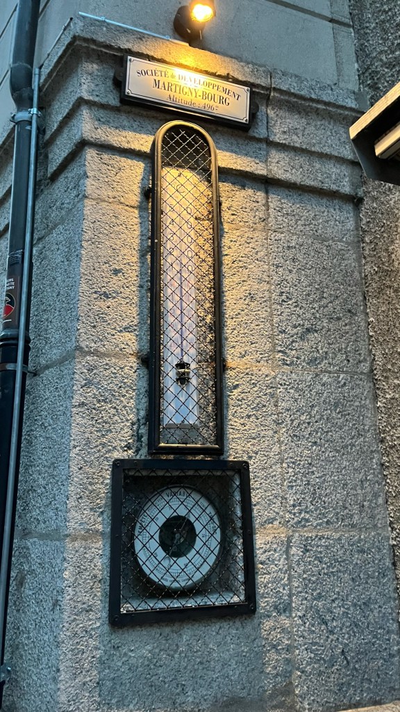
Just before 6:30 this morning, Patrick walked outside of the Martigny pilgrim gite (or “the dungeon” as he called it, since it was the cellar of the priory — and had meat hooks hanging from the ceiling) and declared it was “completely dry.” This was a relief as today’s walk is infamous — described in the guidebook and by other pilgrims as the most technically challenging / dangerous section of the whole Via Francigena. I nodded in agreement, exhausted — the bedroom in the pilgrim gite has an automatic light that turned on when anyone got up to go to the bathroom, so I had been up since 4:30am when one of the other pilgrims needed to pee. Now Patrick and I were sitting in the kitchen area so as not to wake the Beatrice and Daniel, packing our bags and having breakfast, waiting for Sam to arrive.
At about 6:35 we heard a knock on the door and opened it to let Sam in — as he entered, we heard the distinct sound of rain behind him. “So, it’s raining a little bit…” Sam said. I whipped around to Patrick and accused him of jinxing us by saying it was a dry morning, who took the accusation like a champ. So, we put on our raincoats and covered our packs and headed out into the dark, wet city of Martigny.
The town was a lot bigger than I expected, with some less-interesting areas full of uninspiring modern buildings. However, towards the edge of town we passed through another charming historical center, before making our way to the Martigny-Croix train station, per the guidebook the last chance to bail before the difficult bit. After some momentary confusion where we lost the trail, some workmen waiting to start their day pointed us down the platform where we rejoined the path through a picnic area, shedding our raincoats as the rain had slowed to a near-stop.
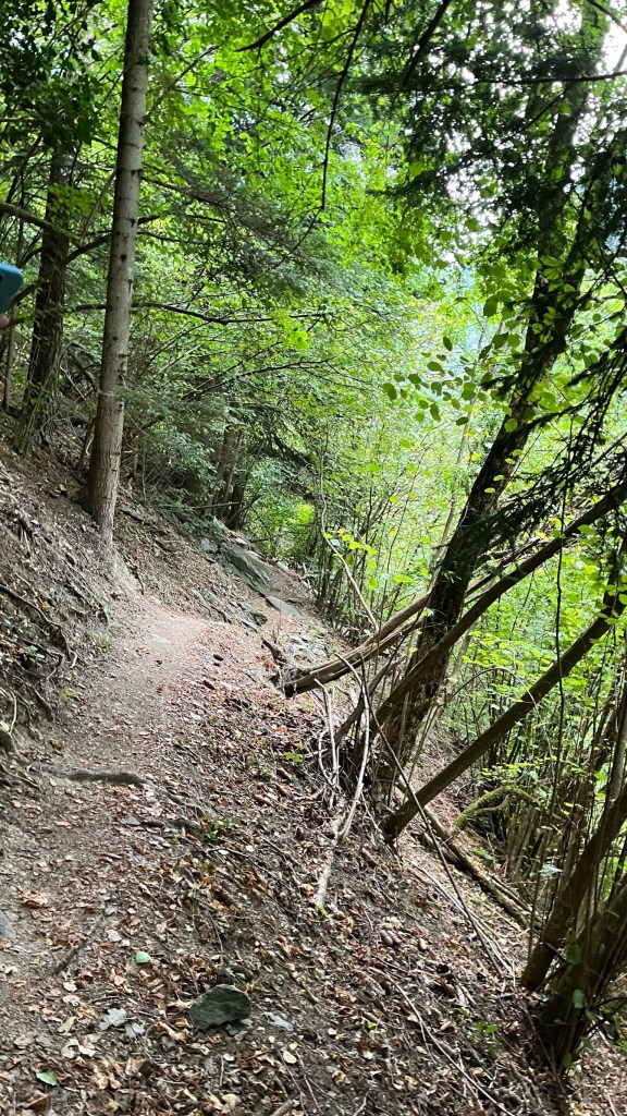
From here the uphill began: up some stairs, under a railroad bridge, on a relatively gentle slope and a wide open path. Then, suddenly in front of us, the path turned off into the woods: a steep, narrow uphill path covered in rocks and tree roots. “Here it is!” Shouted Sam, who was leading the pack. Behind me, I heard Patrick yell “Let’s go!” Adrenaline pumping, we were off, carefully picking our footing on the damp trail which switchbacked up the side of the mountain. It was fully daylight now, and thankfully the rain had stopped — even so the path was slick in areas, especially where covered in dead leaves. It was slow going at first as we made our way up. Then, at a certain point, the path began descending! This was incredibly difficult, and all three of us took these sections very slowly, carefully placing our feet so as not to slip. The path was just narrow enough for one person to stand on it, and sloped down towards the steep wooded drop-off to the river, 20 meters or so below. Falling here would be a bad idea.
We continued on like this for maybe 30 minutes or an hour. According to the guidebook, this was supposed to be the sketchiest section of the trail. In the end, in this section there were only a few areas that had me genuinely nervous: a few descents on switchbacks where as you turned the corner you had no purchase at all as you headed straight down the mountain, a small metal bridge over a creek that slanted down and whose handrail was completely slick in the wet, a few uphills with limited footholds. I sang quietly to myself and focused on moving forward, all the while keeping an eye out for the “handrail on the left” the guidebook described as the hardest part of the section. When we did reach the handrail, the three of us were confused — why this part? There were definitely areas above that felt trickier. In the end, this part of the stage felt similar to many other narrow trails I’ve walked in Colorado — a bit nerve-wracking at parts but not incredibly dangerous (though I’m not sure I would recommend it in wetter conditions).
We crossed the metal suspension bridge over the Dranse River, whose valley we are following today — it swung each time we took a step and I did not stop to take a picture of the rushing river below (I have Sam’s which I will include). Then we were back in civilization for a bit, walking through the town of Les Valettes before stopping in the one open cafe in Bovenier for some delicious croissants and cappuccinos. We sat for a while, chatting and warming up as we were all a bit damp from the rain and sweat — once again another successful stop.
Back on the trail, I pointed out that the guidebook said we may have “a bit of scrambling over boulders” but that the worst should be behind us. In the end I’m not sure this was an accurate description. There were still plenty of narrow, sketchy sections — again, nothing out of the ordinary from what I’ve seen in the US, but difficult in some of the sections that were wet and slick, where all of us would slow down. For many of these sections I was 100% focused on my foot placement, and felt sweat rolling down my forehead even though it was a relatively cool 65 degrees or so. I also did actually slip, not on a treacherous area, but on a relatively steep grassy downhill — luckily I caught myself before falling.
The “boulder scrambling” section was much longer than I felt the guidebook implied, but was also my favorite part of the trail — I enjoy sections like this that are challenging, involve a bit of thinking to pick a good route, but don’t have the same issues as the steep / narrow paths we had been walking. I led the pack for some of this (so absorbed in the walking I almost missed one of the blazes marking the path, until Patrick called me back). It was good fun heading up and over mossy rocks, ducking under massive boulders, and scrambling along, and the forest in this section was absolutely beautiful. I turned around to snap a photo of Patrick and Sam: “Smile — no wait, look tired! Yeah, nicely done!”
After another steep downhill section we emerged from the woods, and ended up walking parallel to the highway for a bit. Sam commented that there was a tunnel coming up — respite from the traffic noise — when suddenly we realized why the tunnel was there. In front of us was the remnants of a large landslide (probably this was an area that slides frequently). We stared at the huge pile of rocks in front of us before realizing the trail was taking us up and over. Even though this section was relatively safe — the trail was wide and dry and it wasn’t too difficult to get good footing on the rocks, I actually found this one of the most intimidating sections. It was a very potent reminder of the power of nature.
We soon rejoined a normal, gravel path through an alpine pasture, which brought us without incident to the medieval town of Sembrancher. The first section of town was very much not-historic, with a large train station and the typical industrial outskirts, but we walked above this section and only descended into the historical center, which was full of beautifully timbered houses. I insisted we pop into the “maison du commune” (no longer the Mairie!) for a stamp, and then we headed off in search of lunch. Patrick had food with him, and Sam and I grabbed ham sandwiches and orange soda from a roadside “Cafe Bar Pizzeria.” It wasn’t even 11, so the full lunch menu wasn’t available — fine by me as I absolutely refuse to eat pizza until I am in Italy. I’ve made it this far, I won’t break now! Patrick came and joined us for a cup of coffee, and we headed out for the final push, which would be either an hour and fifty minutes or two hours and twenty minutes — Swiss hiking signs specify the time, which is nice, but for some reason these signs had two different times for Orsieres without explaining the difference. Anyway, we had made surprisingly good time up until this point so were ready for our final push.
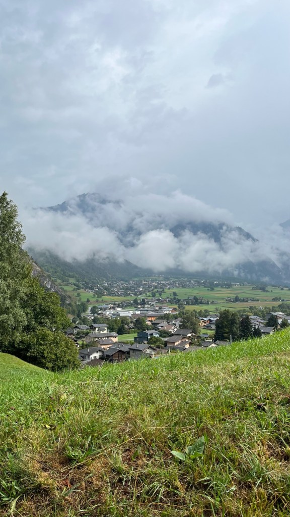
Out of Sembrancher we gained a lot of elevation, quickly. This is where Sam really earned his nickname (per Patrick) of the Mountain Goat — his marathon and trail running training meant he could easily push on uphill, while us mere pilgrims kept stopping to catch our breath and give our poor calves a break. We were now high up on the mountainside, with spectacular views of the valley behind us, where small villages dotted the green landscape, and clouds still hung in the valley. What looked like tiny model trains chugged along through the landscape in the red-and-white livery of the SBB. It all looked so perfectly alpine. I turned to Patrick — can you believe we walked here from England? We both began to laugh in disbelief. Even the lake feels like a very long ways away from here.
We passed through a few small villages up here, and were amazed at the fact that we could see houses even higher up — are these places even accessible during the winter? How did people originally decide to live here? And how difficult this must have been for medieval pilgrims, not equipped with Gore-Tex jackets and hiking boots with treads.
Coming out of one village, we were dismayed to see another forested downhill track so soon after we had just gained all of that elevation — unfortunately there wasn’t much to be done about this so we trudged onward. We crossed another stream, where I lost my footing on a wet wooden bridge and once again almost fell, catching myself (thank you again to my knees, which took a real beating today). Coming out of the forest we stopped for a snack break on a grassy knoll and discussed that was left for the final-final push. I, the pessimist, said we had more elevation gain to come. Sam showed me the altimetric profile for the day and said it wouldn’t be that bad.
So, it was back on the gravel track, crossing high up alpine pastures. We could now see the town of Orsieres down below in the valley. And yet, as expected, the path made an abrupt turn and took us up the hill to a higher road, before bringing us back into the forest for another slippery descent for old times’ sake. Sam was leading the pack again here, and as I rounded a corner I saw he had stopped and was looking back at us. “So,” he said apologetically, “I think this is the last uphill….”
It was not — nor was it short, though it was steep. Really, it felt cruel for the route planners to do this now that we knew Orsieres was down below us — why would be we need more ascent? Anyway, after one more uphill (I gave Patrick a pep talk that was really more for my own benefit — this is no different from the climb into Laon or the one out of Besancon. We have done harder!) we emerged onto one last gravel track with a view down to the village and down the valley where we had come from. The clouds had returned and we were being sprinkled with a light rain — this didn’t stop us from taking quick photos with the Via Francigena sign before speedwalking into town, where Sam and I headed into our hotel and Patrick headed to the tourist office to find the pilgrim accommodation.
After some confusion regarding check-in, Sam and I managed to get our room keys and were ushered into a tiny elevator, which whooshed us up to the second floor with no warning. We almost got stuck getting out of the elevator as it was so tight, but managed to disentangle our packs and safely make it to our rooms. After dropping our things we headed out for lunch #2 of crepes at a place down the street. We sat down and each ordered, when the proprietor came back to us and asked if we speak English. Yes, we do, but why? Well, who should come in the back door of the place but Patrick!
“What does he want?” The crepe woman asked us. We tried to explain that he was a pilgrim, and he was looking for a place to stay. He told us that the pilgrim gite was here. She said no, there was no room here, this was just a restaurant and he needed to go to the Tourist Office. No, he already went to the Tourist Office, who sent him here. Finally, he showed her he had the code for the door, and something clicked — with an “ah!” She dragged him away, leaving us both confused and wondering if we would get our crepes. In the end it was a case of confusing street numbering, and we had a very satisfying lunch. Afterwards we ran a few errands — getting stamps, understanding the situation with Sam’s bus on Friday, since the road to the pass is evidently closed, grocery shopping, etc. and then headed back to the hotel where I took a long nap. Afterwards Sam and I went out to grab burgers before turning in for the night.
Final mileage: 13.65 mi
Walking time: 6h 36m
Elevation gain: 2,943ft
Accommodation: Hotel l’Union. One of two hotels in town, run by a very welcoming couple. Our rooms had great views of the mountains — would do again!


Leave a comment