
Song of the Day: Would That I — Hozier
This is another great walking song, with the intro making a great soundtrack for my way out of Ornans, with thin layers of cloud slowly lifting and the sun peeking out from behind the cliffs.
“True, that I saw her hair / like a branch of a tree / willow dancing on air before covering me / under garden and calicos / over canopy dabbled long ago…”
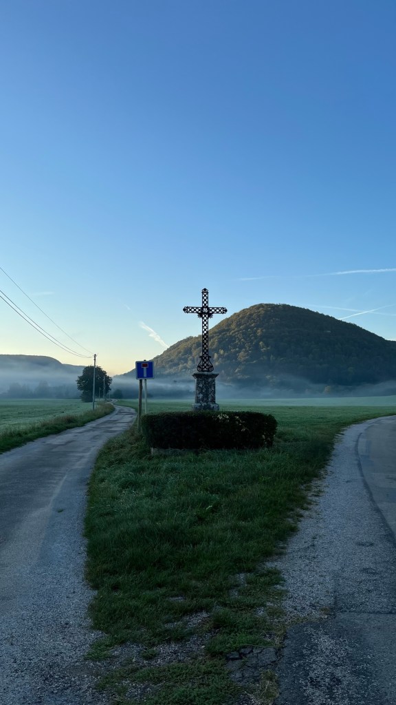
Once again I was up before the sun, packing up my hotel room and saying goodbye to the empty Ornans gite. Kerry and Andy had mentioned that there was a boulangerie open early, so I headed back across the river the pick up a pain au chocolat (not many days of French pastries left!) and a sandwich for later. While there, I ended up sitting next to an Australia woman who was visiting Ornans, but had previously walked other sections of the Via Francigena. We had a nice, quick, chat while I ate, and on the way out I ran into Kerry and Andy. After a quick hello I was back on the other side of the river and on my way up valley.
The view was gorgeous. The sun had not yet crested the cliffs that loom over Ornans, and a layer of thick fog clung to the ground. I turned around just outside of town and admired the buildings reflecting off the water in the early morning light. Clearly I was not the first person to appreciate the view from here — the town had set up a steel “easel” to show Courbet’s view of town.
As I continued up the valley I walked along with flat fields and the river Loue on my left, and high-up pastures on my right. Far off to my left I could see a man walking parallel to me, almost hidden in the haze. Finally the sun crested the cliffs and the fog started to burn off. The path wandered in and out of forest and across fields. I stopped for a bit to admire two horses standing near the river, silhouetted in the sunlight. I noticed that the man I had seen earlier was still behind me.
I don’t really like having people close behind me when I’m walking alone — it makes me nervous — so I pretended to closely inspect a sign until he caught up and passed me. We said a quick bonjour, and he asked what I was doing. I ended up falling in alongside him as we walked at a similar pace (I tend to walk fast, so I was happy to have someone willing to keep up!). Turns out he is a former marathoner, but can no longer run. So he walks 15 kilometers every morning to stay healthy. We chatted a bit about my journey and I asked about the fighter jets that I’ve heard flying overhead (difficult given I couldn’t remember the French word for “airplane” and had to resort to charades), which are apparently joint French / Swiss exercises. He told me that in the early mornings, the fields we were passing would be full of chamois, pulling out his phone to show me a picture. He left me on the outskirts of Vuillafans, where he turned around, saying “I’m not going to Rome!” I wished him well and continued into town, which marked roughly the halfway point.
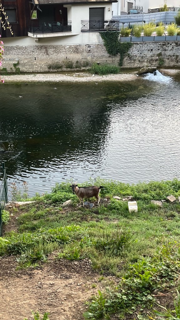
Despite the short distance today, and the fact that the walk was relatively flat in this early part, my feet were causing me trouble. I stopped in town for a snack (an apple and some orange juice) and sat in the shade by the river, with a nice view of the town’s old stone bridge. I will say — I’ve spent a lot of time around rivers so far in France: the Somme, the Marne, the Soane, and many others. The Loue is by far the cleanest — it’s not that deep but you can very easily see straight through to the bottom. It’s inhabited by some very sassy ducks who quack at anyone who dares cross one of the many bridges. While some of the other rivers I have mostly avoided, walking nearby canals instead, I’ve enjoyed tracking the Loue today.
This stop also gave me the opportunity to figure out what was going on with my feet. It seemed like I was developing another blister, which I did my best to take up before heading back out with just under 2 hours remaining.
I was mostly navigating today by following the marked VF signs, and occasionally referring to the official VF app (no Maps.Me for me today). Perhaps I should have been paying more attention to the maps in the app, which include a topographic overlay. I had assumed that any elevation gains from going up valley would be gradual as I tracked the river — this turned out to be false. The section from Vuillafans to Lods started with a quick uphill on paved roads, past a house sporting multiple American flags, before quickly entering the woods. Here is was even more uphill, though thankfully much less steep than the climb out of Besancon. After maybe 30 minutes the trail flattened out and started to descend towards Lods.
In this section, I was listening to music and a bit lost in my thoughts. I came up to a fallen tree – a young, multi trunk tree that had been torn from the ground, roots and all. I navigated around and soon came to a clear section that looked like it had been hit by a landslide. Looking around as I re-entered the forest, I realized it was carnage — broken trees and uprooted trees everywhere, though it was not clear how long ago they had fallen. Despite my frustrations with the heat I was glad to not be here during a storm. Further along I came across a very large tree completely covering the trail. I couldn’t see over part of it because of the branches and leaves. I realized I would have to go off the trail and cross over towards the roots. As I was pondering this, I heard a noise behind me in the woods, I turned around, purposefully making some noise to potentially scare off any creatures, and heard the sound of a large animal struggling in the downed branches in front of me before running away — I assumed it was a deer but I never caught sight of it to confirm. After a very precarious crossing of the tree — my pack throwing me off balance so I basically had to crawl / roll across it, I continued on without further incident.
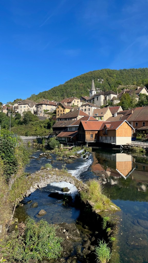
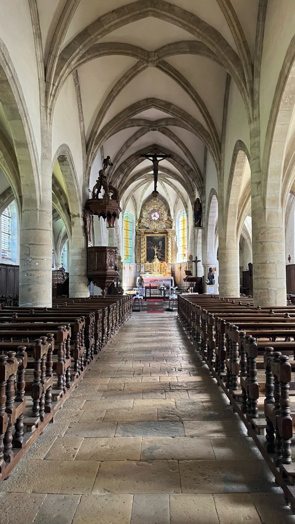
Soon I exited the forest and was headed toward Lods, a small village that apparently was once voted one of the prettiest villages in France. I could understand why — it drapes down a hillside along the river, which cascades down under a bridge. I stopped for a few photos, of course, and then continued on. Interestingly, the VF app here deviated from the posted signs which I was following. The signs take you on a winding route through town while the app takes you straight through (missing the best viewpoint!). I suspect there may have been some chicanery on behalf of the town to encourage pilgrims to stop for a coffee or visit the town’s church. While the restaurant in town wasn’t open when I arrived, after a steep uphill climb I saw the church was, so I popped in for a visit. It was a lovely village church, which was raising money to restore some of the paintings lining the nave. I sat outside and had my sandwich that I purchased in Ornans, in no real rush as I was almost done with my walk. However, with the temperature rising, I decided against visiting Lods’ museum of vineyards and wine to get a move on.
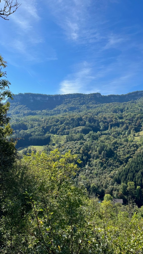
Once again, looking at the topographic map would have been helpful for managing my expectations. Though I only had 30 minutes or so left of walking, the first 15 were once again a steep uphill on a narrow track, with a steep drop off to the side. This was rewarded, however, with a view over the valley to the cliffs on the other side. No longer reminiscent of Appalachia, this reminded me a bit more of some of the hikes I’ve done in Colorado, particularly on Aspen mountain.
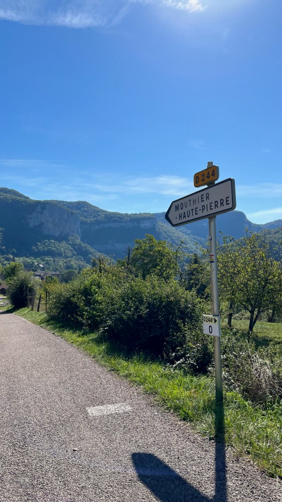
After a quick call to Nathan who was up very early to catch a flight, I descended into Mouthier-Haut-Pierre and immediately checked myself into the pilgrim gite. It’s just me here, so I have the whole 3-story house to myself. The downstairs has a garage and bedroom, then upstairs there is a kitchen on the first floor and bedrooms on the floors upstairs. Despite the very short distance walked today, I was exhausted — I think a holdover from my long walk yesterday. I showered and spent awhile mindlessly staring at my phone before rousing myself to get out into town.
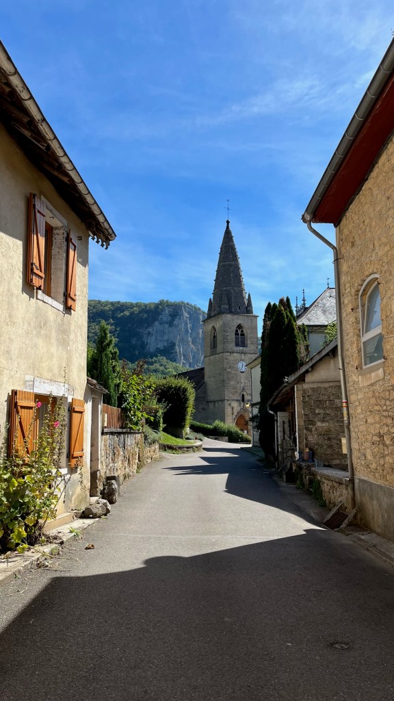
I tried to get a stamp at the Mairie, which had closed at 11, and the church, which was open (and lovely) but empty. In the heat, I clung to the shady side of the street and headed to the only hotel in town which stamped my credential. From there I headed to the only shop in town to pick up some cheese to supplement my lunch, a brioche for the morning, and some eggs to add to my ramen for dinner for a bit of protein.
After a nap I had a late (second) lunch and then slowly went about my pilgrim chores: washing my clothes and hanging them to dry, and then once again trying to better clean out my camelback. The benefit of a small village like this is, honestly, there isn’t much to do other than try and get my next few days in order, do my writing, and listen to the sound of distant cowbells. Now that it’s a bit cooler, I’ll do another lap of the village before dinner and hopefully call it an early night — Kerry and Andy are planning on leaving at 6:15 tomorrow to beat the heat and I’m hoping to head out around the same time. I’m a bit nervous about the Source of the Loue section as the trail had previously been closed, so it would be nice to know I’m at least in the vicinity of others on the trail.
Final mileage: 8.91 mi
Walking time: 3h 57m
Elevation gain: 784ft
Accommodation: Donativo pilgrim gite — it’s a full building able to house a number of pilgrims, and it has a large kitchen for making dinner. It wasn’t completely spotless, but honestly that doesn’t bother me much, and it is a good option for pilgrims on a budget. However, Kerry and Andy’s splurge at a local B&B with a pool sounds like an even better option for those willing to spend a bit more.


Leave a reply to sleddoggie Cancel reply